
")


Blog archive
- ► 2016 (2)
- ► 2013 (3)
- ► 2012 (26)
- ► 2011 (7)
At Facebook
 visit Mt. Buckland at Facebook…
Map material
|
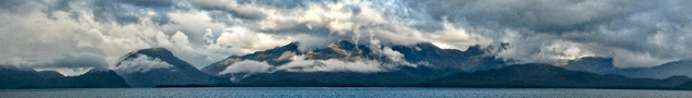
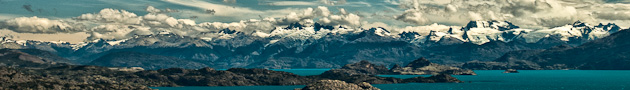
To develop appropriate strategies and look for possible routes through the wall good geographical material is indispensable. The same applies to reports from other teams to participate from their experience. Both possibilities do not exist for Monte Buckland and his surroundings. Almost 50 years past since the Italien expedition climbed Monte Buckland and this was done on a different route. André, one of our cartographers was able to lay his hands on a cloud-free satellite image covering our area of interest. Ground resolution is good enough to support us with knowledge about ice and rock sections or indications for possible camp grounds. In combination with recent elevation data, the satellite image will also help us to navigate while approaching Monte Buckland. |
 |