
")


The following article was published in the American Alpine Journal 2012.
|
Cordillera Darwin | |
|---|---|
|
Monte Buckland (1,746m), northeast ridge and northeast face; Monte Niebla (1,430m), northeast face.
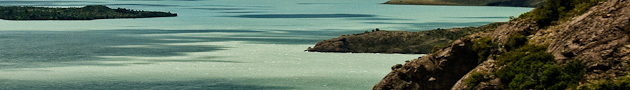
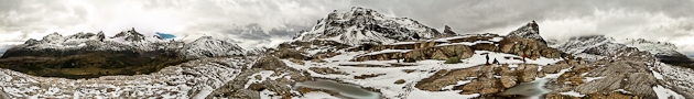
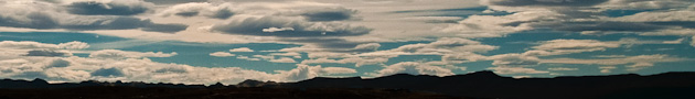
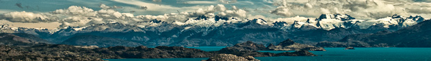
On January 29, 2012, Daniel Gross, Markus Kautz, and I reached the mystical and rarely seen summit of Monte Buckland by a new route, the northeast ridge and northeast face (D). We have called our line Silberkondor after the plane piloted by Gunther Plueschow, a German pioneering aviator who took the first pictures of Buckland’s northeast face during his exploratory flights in 1929. The only other reports on Buckland come from the Italian missionary Alberto M. de Agostini, who explored the area in 1912 — 13, and the notes from the strong Italian expedition led by Carlo Mauri, who in 1966 made the first and, until 2012, only ascent of the peak (summit reached by Allipi, Ferrari, Guidici, Machetto, Mauri and Pirovano). The Italians approached the mountain from the southern Agostini Fjord, and made the first ascent by the southwest face. Scarcity of information, challenging inaccessibility, nasty weather, and impenetrable rain forest couldn’t stop us exploring the fascinating wedge-shaped mountain of Buckland, located in the archipelago of Tierra del Fuego. From Punta Arenas we made a 12-hour drive on partly unpaved and rough roads to the southwest coast of Tierra del Fuego. To the south we caught the first glimpses of our goal, the snow covered peaks of the Cordillera Darwin. Crossing the fjord next day with two inflatable zodiacs, and passing east of Isla Dawson, we reached Fitton Bay (Bahía Fitton). After we’d unpacked our ca 450kg of equipment, the boats returned, cutting us off from civilization for the next three and a half weeks. Incredibly, it took five long and hard days just to establish base camp (300m), less than five km from the beach. These exhausting days were due to horrible bushwhacking through dense rain forests, which were often only passable with machetes, and negotiating open swampland. Added to this, the rain soaked us, made us freeze, and brought us close to despair. |
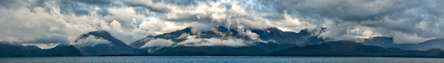
Over the next few days we explored the nearby area and climbed a relatively low hiking peak south of Buckland, naming it Monte Bella Vista (825m) after the beautiful view of surrounding peaks. Then Gross, Kautz and I made our first attempt on Buckland. From base camp we went west to access the glacier beneath the east pillar. We then traversed the lower glacier, exposed to the fall of the seracs that overhang the entire east face, to reach the northeast ridge, where we set up high camp at 1,100 m. The next day we climbed the first pitches of the ridge, but had to abort the attempt and return to base camp due to bad weather. On January 29 we made a second attempt from high camp, climbing mostly ice and mixed terrain to reach the upper glacial plateau below the summit headwall. Passing a difficult bergschrund (WI4), we followed the obvious central couloir (up to 65°) to the narrow summit ridge. In nearly whiteout conditions, we turned south and climbed the icy top considered to be Buckland’s highest point. It was 12-hours since we’d left camp but more than four decades since this point had been reached. After the ascent weather conditions worsened, with snow down to base camp. Nevertheless, on February 2 Franz Goerlich, Gross, and I were able to make the first ascent of an unnamed peak we called Monte Niebla, a tribute to the bad weather at the summit. We first followed the main valley southeast from base camp, then after two km went steeply north to reach a glacier west of the summit. From here we reached the northeast face. A snow ridge and 30m of loose rock led to the summit (AD-). Weather now forced us to remain in our tents for the rest of the expedition, frustrated after seeing such splendid unclimbed mountains as Monte Sella. Further details available at www.mtbuckland.com |